Nestled between the neighborhoods in Orange, CA lies 340 acres of beautiful park known as Peters Canyon Regional Park. Here, you’ll find a decent size reservoir, miles of hiking and biking trails, and great wildlife and bird watching opportunities. There is also another thing that you’ll find lots of… people.
Peters Canyon Hike at a Glance
- Trailhead – Jamboree and Peters Canyon Road, Orange, CA
- Roundtrip Distance – 5.41 miles
- Time – 2 to 2.5 hours
- Difficulty – Moderate
- Elevation Gain – 823 feet
- Pet Friendly – Yes, on leash
- Parking Fees – $3
To get there, take the exit for Jamboree Road and head east for about 5 miles. Turn left and at Peters Canyon Road and the parking lot will be on your left. We arrived on a Saturday morning just before 8:30 am and were lucky to get one of the last parking spots in the lot. There is no parking on the street here so if the lot is full, you probably don’t want to hike here anyways because it will be busy. Parking is $3 at the parking machines or included with an annual OC Parks pass.
From the parking lot, walk south (heading back in the direction of Jamboree Road) past the ranger station and through the wood chip lot. You will see the trail entrance just past the ranger station. From here, the trail is relatively easy to follow, but there are a few areas to navigate.
The first is when you get to the hill in the below picture. Stay left and go straight up the hill. You will go up and over this and then be on a ridgeline for a while. Stay on the main trail, which will pass by some very nice houses on the left. I would have given anything to jump in one of their pools after all that elevation gain.

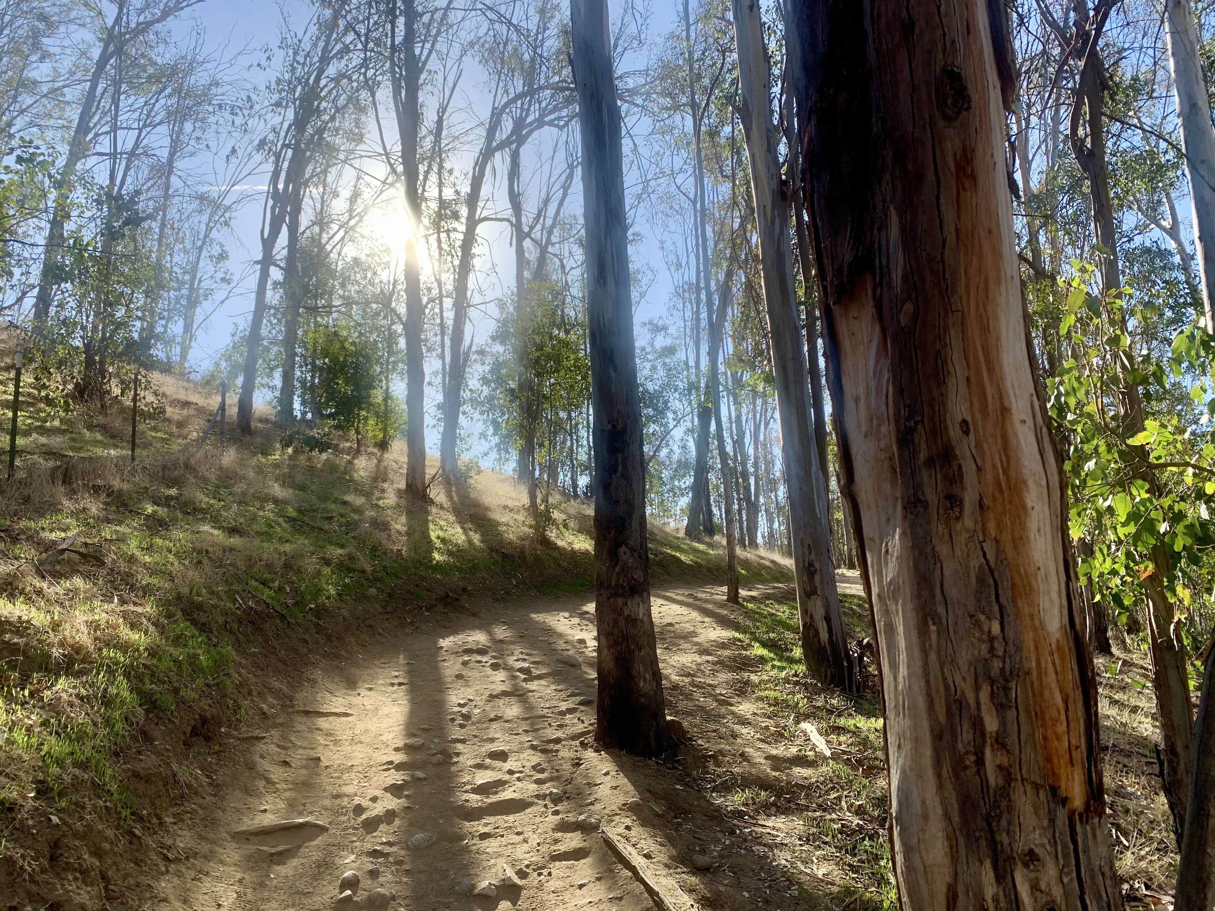
The trail will eventually steer you right, but if you stay on the main trail, you won’t have any issues. You’ll then begin to descend through a beautiful eucalyptus grove. At the bottom of this hill, you’ll pass through a break in the wood rail fence, see some port-a-pottys, and then the trail will pick back up to the right, as pictured below. This was my favorite part of the trail. It was wide (which was very welcome with COVID), shaded, and had some pretty scenery.


This trail will eventually meet right up with where you headed left to go up the big hill. You can either go back the same way you came, or do what we did, and go left which will take you below the reservoir. You’ll climb a hill with a cool cactus garden, and then be rewarded with an awesome view of the reservoir (which oddly enough, I didn’t get a single picture of!).

You’re on the home stretch at this point and will pass through some marsh lands before arriving back at the parking lot.
Overall, I liked this hike and would definitely do it again, just not on a weekend with the current pandemic. There were way too many people for my comfort level, not enough masks, and hikers that didn’t feel the need to give you any space as you crossed each other’s paths. If you do this hike, I hope you have a safe and enjoyable time. It is beautiful and a great workout! Cheers to happy and healthy trails.
Leave a Reply